The Fire Behavior Triangle and Your Home
In order to best protect your home and community from wildfire, it is imperative to understand how wildfire would interact with the surrounding environment.
5 min read
The wildfire behavior triangle is among the first topics every wildland firefighter in training is taught. If you live in a moderate to very high fire risk area, you should understand these concepts and how they apply to your home and your community. These are the building blocks to protecting communities from potential wildfire destruction.
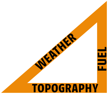
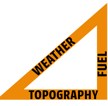
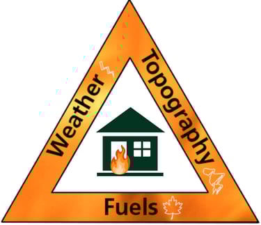
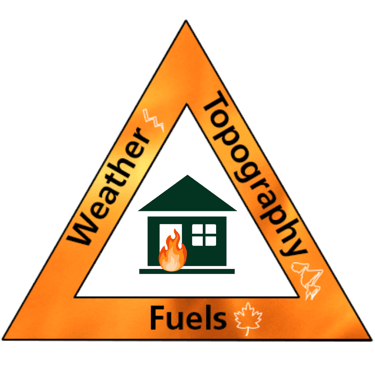
The fire behavior triangle consists of weather, topography, and fuel. These three elements determine wildland fire behavior. Meaning - they govern how severe a fire can burn. Given the right conditions, dry fuel, steep hillsides, and high winds, they can create extreme fire behavior. Which is when we experience the most destruction.
The fire behavior triangle applies to wildland fire. Once fire reaches communities, fire behavior is also determined by the built environment. So, in addition to weather, topography, and fuel, we need to consider how our communities have been built and how that might affect the spread of fire. Housing density, building geometry, and more will be key factors in fire behavior and spread.
WEATHER
Wind is the primary driver of wildland fire’s rate of spread and severity. Technically, the fire behavior triangle should be an isosceles triangle, as wind can be the determining factor between a low severity fire and high severity, destructive fire.
Knowing weather patterns, especially wind patterns, is incredibly important to understanding how fire will interact with the landscape. Does your community experience strong afternoon winds? From what direction?
Weather is the state of the air and atmosphere at a particular time and place. Weather is the least predictable and controllable leg of the fire behavior triangle. Yet it is the most important.
That is why it’s so important to pay attention and take extra precaution during red flag days.
TOPOGRAPHY
Topography is the description of the physical features of an area. Knowing the topographical layout of your home and community can help you understand how a fire could reach your own and your neighbors' homes.
The main items you want to know about the surrounding terrain are slope, aspect, and note any special physical features.
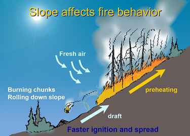
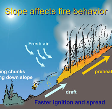
Slope describes the steepness of the land. Hills. Do you live in a hilly neighborhood? Is there a steep slope on your property? Fires tend to move faster uphill because flames are closer to potential fuel, preheating the fuel, and resulting in a faster rate of spread.
Aspect is the compass direction a slope faces. What cardinal direction does your home or neighborhood face? Aspect affects the daily amount of sun heating an area gets, air temperature, and moisture retention of soil. In basic terms, aspect affects how hot and dry vegetation is. South facing slopes are the hottest slopes because they receive the most daily sunlight, so they are the most susceptible to fire.
Finally, consider other physical features of your neighborhood. Namely, are there canyons in your neighborhood? Canyons alter wind flow and create wind channeling, accelerating a fire’s rate of spread.
FUEL
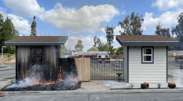
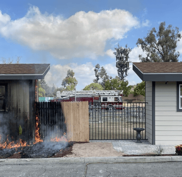
Fuel is any material that burns. In a wildfire, that is typically organic matter or vegetation. When fire enters a community, we must also consider residential fuels or combustible materials found around one’s property. Sheds, tires, storage bins, doormats.
Knowing what fuel exists on your property, both vegetative and residential, and how it will burn is crucial.
What kind of vegetation is growing on your landscape? Do you have native vegetation? How do you manage your vegetation?
What kind of residential fuels are on your property? Do you have a wooden fence around your entire property that attaches to your home? Do you have combustible storage or decorations next to your house?
Considering the fuel on your property is the first step in creating defensible space.
THE BUILT ENVIRONMENT
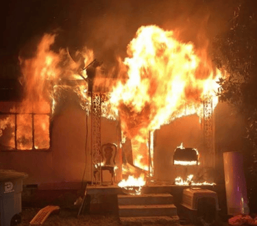
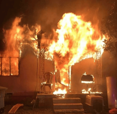
The fire behavior triangle provides vital information on how fire will interact with a landscape. However, things get more complicated when fire enters communities, or the built environment. Fire is opportunistic, anything that can burn will feed the fire and act as fuel. This includes homes and buildings. The items we store inside our homes are super flammable and even explosive!
In order to keep fire out of our homes, we need to understand the factors of our built environment that can influence fire behavior.
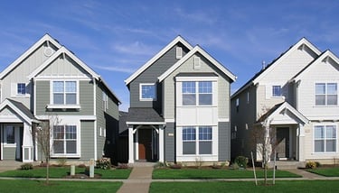
HOUSING DENSITY
In higher density neighborhoods, where houses are closer together, there exists a greater risk that homes can ignite neighboring homes through radiant heat, direct flame contact, and ember exposure. In other words, in high density neighborhoods, the primary fuel is the homes themselves! Houses that are farther apart from one another are less likely to serve as an ignition risk factor to one another.
Folks living in high density neighborhoods need to work together to harden their homes and create defensible space. The cooperative approach will best protect homes, as individual efforts on single homes can be futile if a neighbor less than 30 ft. away has not taken the proper, protective steps. Programs like Firewise USA are a great place to start the organizing and cooperative effort.
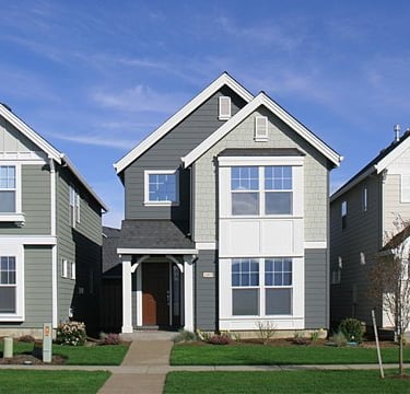
BUILDING GEOMETRY
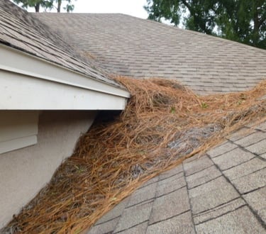
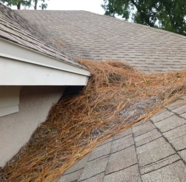
The shape of a building can influence its risk of ignition. This is in direct relation to the fact that 90% of home ignitions are due to embers.
Wind carries embers ahead of the body of a fire, embers land in communities, in yards, and against homes. Ember storms can bring a shower of embers into communities. Just like fallen leaves in autumn being blown around and piling up on roofs, in corners of homes, and under decks, embers accumulate. The more complex a building or roof is- with corners, crevices, and nooks-, the more opportunities there are for embers to accumulate.
Adding non-combustible components, like flashing to a roof or non-combustible siding to a home, will help protect from ignition of the accumulated embers. Keeping those areas clear of combustible debris, like pine needles, leaves, etc. is also imperative.